Thursday, June 30, 2011

Smoke Gets In Your Eyes

Shiprock
Who wouldve thought you could go to Cuba to partake of New Mexican food? OK, that is Cuba, New Mexico, which I never did find out the correct pronunciation of. If it was Spanish influenced, it would be more like Koo-ba as opposed to how us Gringos might pronounce Cuba. Regardless, this was our first encounter with New Mexican cooking, at a surprisingly pleasant restaurant dubbed El Bruno. We had done the typical long haul, starting out at the Monument Valley, and had crossed from Arizona into New Mexico. We drove a bit out of the way, taking the highway about four miles south of Shiprock, so Andrea could get a close-up view of the legendary rock itself, made special mostly because it rises in solitary dignity above the surrounding high plains, instead of being part of a massif as one might see in Capitol Reef. Along the way we passed through Farmington, which clearly demarcated the differences between Arizona (and the Navajo Nation,) and New Mexico. The big retail push there seemed to involve the word Adult, and I realized that liquor laws in the state mimicked those of California, meaning that hard booze could be found just about anywhere, including Walgreens, quick-stop convenience stores, you name it. The economic engine is energy, with active pumps and wells in the formations around the city. The Chama River provides a bit of redemptive greenery, but mostly its a barren, plantless series of rolling folds in the land (see Andreas post about plants and the Navajo. Maybe they like it this way. Go figure.)

All this driving eventually brought us to Cuba, NM, and El Bruno. Our friend Elinor had alerted us to the fact that multiple fires were burning in New Mexico, and that perhaps we should apprise ourselves of the possible consequences to our travel plans. This proved to be prescient, as the fire in the Los Alamos area had completely closed our original path of travel through the Valle Grande (Valle Caldera,) crossing the amazing, huge meadow left by a massive blowout some tens of thousands of years ago. You can follow the saga of this area right here if youre that kind of person: http://en.wikipedia.org/wiki/Valles_Caldera

Smoke in Abiquiu Obliterates the Daylight
At any rate, thanks to the Las Conchas fire in the area, plans needed to be changed. Forest Service firefighters were coming and going from El Bruno, and let us know that our alternative route, via Abiquiu on New Mexico Route 96, was open, although all activities south of the highway (like camping, hunting, fishing) were shut down and prohibited. That didnt affect us, although I am sure that hundreds if not thousands of intrepid campers and fisherpeople were devastated. So we headed north and then east to Abiquiu, passing the impressive and massive Abiquiu Dam and its resultant and eponymous lake, continuing to the town. We passed scenes along the Chama River that seemed familiar; of course! They were the inspirations for numerous Georgia OKeefe compositions. In town the smoke trail of the fire descended upon us, turning the sky dark and ominous, and filling our nostrils and lungs with the smell of burning brush and wood. After a brief visit to Boyds general store, we pushed on, and after a short while outran the miasma of smoke. Daylight returned, and the air slowly cleared.

Pole-ish Car Washing Technique
Santa Fe has been a brief respite from our relentless push forward. It is hard to believe that the U.S. of A is so damn immense that even 32 days (with of course a few stops to enjoy the company of friends and family) is barely adequate to go back and forth. At least here we can compare the virtues of red and green chile sauces in multiple settings, until, upon dawning, we choose again to take to the highways and byways. And we can watch the battle against the fire from a respectable distance. I have taken this occasion to give the Versa what I call a Polish (as in the country) car wash, or what Andrea calls a whores bath. This consists of waiting until it starts to rain, and then running outside (in my bare feet) with the rain falling and thunder clapping, with a yellow microfiber rag, and wiping down the car, letting the rain do the rinse. Aside from being ecologically sound, this is also insane, and I am sure provided rich entertainment for any observers in our motel community. I also reached inside the door wells and trunk lids and cleaned away all signs of red rock dust, in case Mr. Hertz takes issue with our usage of his machinery at a later date. Tomorrow is all about a long haul across interstate highways, with two possible entertainments on the way: the Cadillac Ranch (tail-finned Cadillacs buried nose down in the Earth,) and the Country Barn in Amarillo, a meat place that serves unique steaks and burgers from a lean, South African breed of cattle that one family introduced in the area a while ago. Go figure. I will report in on this carnivore exercise, maybe as soon as tomorrow eve.

One humorous vignette from the local news last night: the Governor of New Mexico held a press conference, and said that if you watched the national news you would have the impression that the entire state of New Mexico was on fire, which he strongly denied. Y'all just c'mon down to our fine state and spend those tourist dollars. Then the news station in Albuquerque followed up with a map showing that there were about a dozen fires burning all over the state, most poorly controlled and geting larger by the day. I suppose you could let your eyes be the guide. 

What happens in the car

Wheeling through the Southwest
    So we have had some LONG days behind the wheel --- actually.... every day, so far, has been a bit too long behind the wheel.  I guess we are not as young as we used to be, and maybe were a bit too optimistic about how much mileage we could put on the old speedometer before we started getting worn out. Yesterday we landed in Santa Fe and we are here for two nights, so we can unwind a bit before we hit the road again for a pretty long run to Oklahoma City on Friday. Since my hubby has been doing such a splendid and descriptive job of describing our voyage so far, I thought I would ramble on a bit about some of the things that happen in the car for all those hours.

The View Hotel at Monument Valley
     We had a discussion about ambivalence and the Navajo. We learned that the Navajo are descended from hunter/gatherers and this seems to be reflected in the choices they make (or were inflicted upon them by us whiteys????) in their choice of residences. We passed many of their living quarters, out in the middle of nowhere and in the midst of small towns or settlements, and almost without exception, there was not a  plant, or a tree, a flower pot, or a garden or anything green anywhere near any of their buildings.  To us it looked unbelievably bleak and barren. Extreme poverty. Is this due to lack of water, lack of choice, or the fact that they are descended from nomads and don't want to grow anything? Does the setting seem as bleak to them as it does to us?  Does anyone know? They seem to be a culture that isn't very materialistic or concerned with externals. They are not keeping up with the Joneses, or the Ortegas. So the ambivalence part comes in when we stayed at their new, somewhat fancy hotel at Monument Valley. It is called The View and is right there amidst the incredible stones. It is Navajo owned and run. On some level they must want to market themselves and be appealing to tourists - - or do they want their privacy and space to live their lives?  Probably some of both. Their fancy hotel did not have that much curb appeal, but inside it was quite nice and everyone was very accommodating and pleasant. They have a road that winds for 17 miles through the Monument and is open to tourists but they warn you that the condition of the road is very rugged --- do they not really want you to go on it? If they did, surely they could make it easier to access - - they must have a bulldozer or two around.  This all was part of a larger discussion about ambivalence and how annoying it is.  Life seems so much easier when one isn't ambivalent .... jeez..... just make up your mind already.
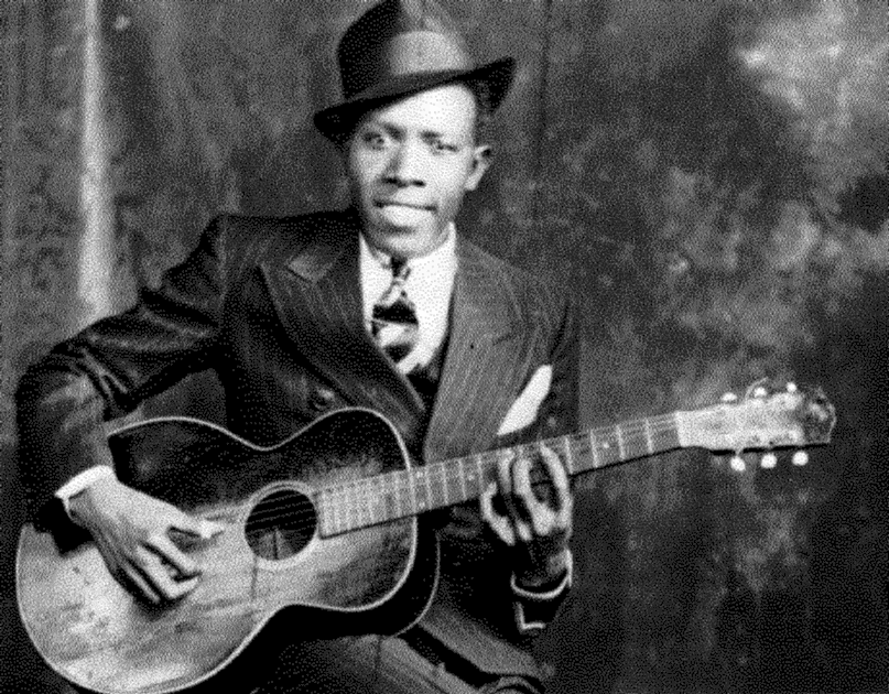
Robert Johnson

     Other things that happen:  Despite the extremely small and limited space in our car, we spend an inordinate amount of time trying to locate items we might need --- they are always in an inaccessible spot or simply disappear.  We occasionally listen to oldies music --- when I can prevail on JD to let me -- and yesterday we were  comparing Robert Johnson's original Sweet Home Chicago to Freddie King's, and discussing Michael Bloomfield's Electric Flag version of Killing Floor vs. Howling Wolf's.  For the run to Oklahoma City we are planning to download some NPR podcasts and some more music.

    Okay... the altitude is getting to me.  Can't go on anymore.

xxx Andrea

Wednesday, June 29, 2011

Rock Festival


One thing thats already quite clear is that this is an enormous country, and it has some capacious states in it, especially if you traverse the entire length or breadth of them, or both at once. In this case, Utah has proved to be quite the crucible in which we test the relative wisdom or folly of our flight plan. For a third day in a row we have driven for many hours (some in our party might argue too many hours,) and it has led to a high level of road weariness for one of us, probably exacerbated by going to sleep early and waking up way too early and staying awake no matter what. This may be a familiar scenario for some of our followers; I tend to go in the other direction, which is to stay up a bit late, mostly to finish this blog so I dont let our thousands of avid fans down, and then I am a bit of a laggard come the dawn. Or even a couple of hours after the dawn. So there is a natural tension working here, based around sleeping patterns and waking hours. Combine that with eight plus hours of driving, and no matter how amusing the scenery, the regimen takes its toll.
The Long Canyon on Burr Trail
That being said, today was probably the greatest eight hours of driving in our family history. This was the day we tackled the Burr Trail, and I must say it exceeded all expectations. This is not a drive for those who are uncomfortable on gravel roads; there is a not-too-long segment that is (for the moment) very well maintained and drivable, but this road can turn on you in a moment should an afternoon thunderstorm unleash its fury on the bounteous unconsolidated soils and sands of the high desert. Another deal-breaker for many would be the apparently notorious Burr Trail switchbacks. I have learned that when you see switchback on a Utah map, that basically means the road builders ran into a situation where a mesa terminated in a cliff, and they hacked a solution into the face of it that requires you descend in first or second gear, pumping your brakes so they dont fade, and fighting your steering wheel, which is gyrating madly thanks to the washboard surface it is traversing. This is in good weather, mind you. Speaking of minds, the Versa occasionally had a mind to trade its front end for its rear on the gravel, but thanks to the teen years driving in snow, and country lane experience visiting John Daniels family cabin in the hills of Virginia, I instinctively compensated for the cars ill behavior. This descent of a sheer face followed a cruise down the Long Canyon. If the U.S.A. were looking to create new national parks instead of privatizing the ones we have, the Burr Trail portion of Capitol Reef should be the first place to be included. This drive through walls and towers of red rocks, squeezing in from both sides, surpassed anything we have done in officially sanctioned parks in this country. And even before the Long Canyon, we had been treated to a vast variety of landscapes, colors, vegetation and eco-systems. On the way to the Burr Trail, Utah Scenic Route 12, arguably the finest scenic highway in the country, reached an altitude of over 9,500 feet, and stayed above 8K feet for miles and miles. Vista points stretched for dozens of miles in every direction. Who knew this would just be the warm up for the Burr Trail? Interesting statistic: Other vehicles encountered over 110-plus miles of driving. Answer: three cars, two bicycles. Empty country.

Andrea at Muley Point
After the switchbacks, the countryside became progressively less dramatic, though not without its charms, until we arrived at Lake Powell in Glen Canyon Recreation Area. If your idea of fun is to rent a house boat and sit on a captive lake for two weeks in 100 degree heat, this is your place! For us, the highlight was catching the ferry, a 25 minute ride across that was relatively bracing considering that the thermometer was somewhere between 104 and 108 degrees. We cruised through another panoply of environments until arriving at the turnoff for Muley Point, said by Ansel Adams to be the premier vista point in the country. Hes right. It is up so high, and the edge is so sheer (and unprotected) that I could not bring myself to more than eight feet from the edge (I do have an incipient fear of sheer drop-offs.) Even from my chickenshit post, I could see the goosenecks of the San Juan River folding back upon themselves; the distant view of the Monument Valley; the bizarre shapes of the denizens of the Valley of the Gods; and endless majestic red faces of the mesas, crumbling in their antiquity. It was fully worth the five miles (each way) on dirt roads. Notice the theme here: lots of dirt and gravel driving. It goes on. Rejoining Utah 261, we took a right and the pavement abruptly ended. What followed was Muki Dugway and a stomach wrenching mile-plus descent of another cliff face, with no pavement and 180 degree switchbacks, basically piled upon each other. At one overlook you could peer down and see the road curving this way and that, and finally ejecting itself at the base of the cliff across yet another expansive plain. But from the road looking up, the cuts were invisible. Perhaps some weird form of Anasazi voodoo, except I dont think they practiced that.

One of the Gods
One of the Goosenecks. There are three next to each other
Any sane person at this point would have cut a beeline to the hotel in the Monument Valley, but I seized the opportunity to revisit the under-rated and lightly-trafficked Valley of the Gods. This is often billed as a junior Monument Valley, but in some ways it is far superior. You wind around on (you guessed it) dirt/gravel roads for a fairly tortuous 16 miles, but the trip is worth it. Like all these roads, they are impassable when wet, but there was no chance of that today. The Valley is filled with vertical columns worn into oddly human or animal shapes; theres just no way you can perceive it otherwise. The road was full of roller coaster dips, and steep upswings that left you very uncertain of which direction the path would take at the top. The order of the day was: take it slow. And thus we survived. Yet another amazing piece of scenery. We had seen so much that scenery overload was building up. But what trip to this area would be complete without a stop at Goosenecks State Park, where the San Juan folds upon itself in deep canyons three times within a very short distance. Thanks to a handy guard barrier of rocks I was able to bravely stand right at the edge and take some shots, which required a much wider angle lens than my Lumix had to offer if I wanted to capture all three folds in one frame. Bring on the Photoshop.

OK, mission accomplished - - time to hie thee to the hotel in the Monument Valley. Leaving Mexican Hat you climb up a pretty steep hill, and it is made much less enjoyable by the fact that there are a succession of what appear to be gravel-hauling trucks with two trailers. The one in front of us was creeping up the long grade at all of about seven MPH, but we were mercifully able to pass it after just a couple of minutes. We arrived at the Monument Valley in about a half hour, and made our way to The View hotel. But enough for one blog; maybe Andrea can fill in some of the other details. If not I will blather about them at another sitting. Thanks to the lack of effective in-room internet, this post will probably not make it until tomorrow. I am sure all of you are feeling deprived of the nightly feed, but you all will just have to make do until we return to what we define as civilization. The Navaho Nation is not it, although it has its own charms.

Monday, June 27, 2011

Interstate Travel

Once you get to Torrey, lots and lots of this!
Today had an enormous dose of driving on various roads with "I" in front of their numeric designation. We cruised out of Boise on I-84, which loosely follows the path of the Snake River towards the Utah border, and passes through some very rugged, beautiful, desolate and virtually uninhabited country. Then it merges with I-15, which connects Idaho, central Utah, Las Vegas and Los Angeles in a more or less north-south configuration. Once again the 75mph speed limit was a godsend, and because of the lack of population, the drive was free from the usual repetitive sequence of Wal-Mart, fast food, Home Depot, and you know the rest. That only lasted until we drew near to Salt Lake City. I do have a few observations about the place. First, drivers there, on the whole, are completely type A to a degree I have not seen in any city thus far (maybe I should drive more at commute time.) Now I know that speed limits have little to no meaning in many places, but Salt Lake City takes the cake - - try 80 in a 65 zone, or 75 in a 55 zone. You'd think this would be a matter for the Highway Patrol to crack down on, but the opposite is quite the case. Policing in Oregon and Idaho was as close to nonexistent as possible (we saw only one cruiser per state;) in Utah we saw exactly two traffic stops in over 120 miles of urbanized driving. In fact, it was not until we got to the little towns near Torrey, in the middle of nowhere, where both local and state cops had set up your good old fashioned radar speed traps, right where the signs said you had to drop down to 35mph, just after cruising at ridiculously high speeds through the countryside. We witnessed no stops, but they seemed inevitable. On the other hand, Utah is the first place I have seen a posted speed limit of 80 on the Interstate (south of Salt Lake City,) and that's with just two lanes in each direction. Better yet, rural two-lanes carry a 65mph limit. Even so, you'll find plenty of drivers exceeding that. Vicious and unpleasant. The good news: at those speeds you're done with the Interstate in Utah in quite a bit less time. Too bad the state is so huge. That was a long Interstate roll.

If you're worried that the Stimulus money had no effect, you haven't seen the highway projects in Utah. Most of I-15 is being either repaved or expanded, over a range of more than 100 miles. It would appear that Utah got a massive share of the great government handout.

Diabolo's Sope  and Salad Wrap with Smoked Chicken
That is not to say that the day was not completely free of pleasures; we had two exceptional meals. The first was at Red Iguana in Salt Lake City, where we indulged in a plate of their Molé Negro. I had watched this being made on Guy Fieri's show (via YouTube.) This is a festival-style molé that includes Mexican chocolate, but their version is far more complex, with layers of flavors including roasted and rehydrated peppers, toasted nuts, numerous herbs and spices, and even more. Ours was loaded with shredded turkey and was lovely to eat - - new flavors suggested themselves continuously, and the level of spiciness was not quite mild, but built slowly to the end. I had to restrain myself from licking the plate. The joint is totally funky and the rice and beans could have come from just about any Mexican place, but the molé was indeed special (they make seven different varieties, from scratch, every single day.) The evening meal was in Torrey, at Cafe Diablo. The culinary school-trained chef has been at it for 16 years, and has a polished style that splashes multiple colors and tastes, based on Southwest cooking, on to every plate. He uses elevation as another intriguing element, and both deconstructs and reconstructs dishes into unique formats. Reading the menu only gives a sense of the ingredients; the real art is in the composition. Herbs are grown in a beautifully tended garden right outside the dining area (you walk through it to check in.) It was warm enough to eat outside, which was another bonus, and everyone connected to the place was caring and attentive. So, a nice way to finish the day.
Just west of Torrey, UT


Tomorrow we have four or five hours of poking around various rock formations, twisting rivers and unparalleled scenic viewpoints. I hope to come up with some blog-worthy photos to document the trip (this includes the John Burr Trail adventure mentioned early on by Andrea. Hopefully the Versa will remain upright and away from any ruts that might hang it up.) Film at eleven.

Sunday, June 26, 2011

Climbing Up

Today was an elevating experience. Quite literally. After starting out darn near sea level from our cozy loft in the Pearl District of Portland, we transited any number of passes above 4,000 feet, and a couple reaching to nearly 6,000 feet in our travels today. As far as those map links I sent, the first part is irrelevant, since I immediately deviated from plan. I took a look at ODOT.GOV, which is Oregon Department of Transportation. Foolishly, I clicked on the Scenic Byways link, and realized that the relatively efficient path I had chosen, which already had us off the Interstate for most of the way, was hopelessly lame compared to what ODOT had cooked up. So, tear up day one of the maps.


It was our fondest desire to get off to an early start, but alas - Mr Hertz does not open until 8AM on Sunday. So we hiked down to their office, picked up our car with a minimum of hassle (thank you, AAA, for the free Gold membership . . .) and drove back to the apartment, parking in the street. Loading up took far longer than one might think, plus we have a pretty complex wind-down ritual that includes such things as temporarily mothballing the automatic espresso machine, turning off the hot water heater, unplugging all voltage-sucking devices, and so on. So a crisp departure was not in the cards. In fact we felt lucky to pull away from the curb just before 9:30AM.


The journey commenced with the usual haul down I-84 through the Columbia River Gorge, eastward just past the Dalles. It seems funny to say, but living in Portland brings about a certain complacency about traversing the Gorge. Pretty much everyone who is not terminally jaundiced or sadly blind experiences an eye-opening epiphany when they first encounter the vertical tumbles and walls of rock, the multiplicity and variety of falls and the nearly incomprehensible volume of water running down the parallel Columbia River. But after a few dozen trips, it becomes, well, just - - the Gorge. So it is hard to look at it with fresh eyes, but we did our best, especially as we moved east into less familiar country past Hood River and the Dalles. As you leave the National Scenic Area there is a palpable change in the environment, which moves from relentlessly green to something a bit more California-like, with dry brown patches already showing after a near record-setting wet winter. 


A bit thereafter we turned south on US 97, a road we're more familiar with in its Klamath Falls and Bend sectors. This time we commenced a southward climb out of the Gorge that was unbroken for 13 straight miles, and actually continued upward with just a few dips for a full 20 miles. The day was clear and just a bit hazy thanks to prevailing high pressure, but that did not prevent a mind-boggling sequence of mountain views, starting with the often hidden and elusive Mount Adams popping up in the rear view mirror, and Mount Hood at our right side. As elevation continued to be put on, Mount Rainier poked up rather obviously behind Adams. Further along the way, Mount Jefferson asserted its pointy and substantial self, and as we continued to gain elevation and travel southward, the Sisters, Mount Bachelor and the rest of their companions showed their heads and shoulders. At best spots you could experience three, four, five or six mountain peaks, all in one panorama. The rise out of the Columbia River Valley was one of the most dramatic driving and travelling experiences I have ever had.


Pallisade formations, John Day Fossil Bed
The next twist and turn was on to a minimal two-lane highway dubbed Oregon 218. There are highways, and highways. OR 218 is one of those roads where they don't build any overpasses. Instead the road follows every twist and turn of a stream, or folds upon itself in tortuous switchbacks as it ascends and descends hills and mountains that interstate highways would blithely slash through. It's about as close as we are going to get to reliving the pioneer experience - - always better with at least 150 horsepower in front of you. OR 218 fed into OR 19, and then to US 26, and finally back into I-84 and down to Boise. The variety of landscapes and ecologies was satisfying; 218 was notable for following the John Day River, which was raging along at near-flood levels. The massive rock structures on both sides of the canyon looked like volcanic layer cakes, with exposed vertical basalt columns interspersed with layers of topsoil. At every turn there were new geological formations, and the rocks were imbued with many hues, including cupric oxide green, limestone, red-purple basalt and endless varieties and blends. The geology of the area is quite naked - - that is, the various layers show quite unabashedly. I am sure our friend Jim Jackson could explain it all, but that is a topic for another week. We made only cursory stops at the Fossil Beds, which were visually stunning and deserve a short hike, most likely in the spring when temperatures and sunshine are a bit abated.


Once we left the John Day River it was basically a game to see how fast we could get to Boise. US 26 obliged us by being singularly empty of cars and people. The little Versa (see Andrea's post) was more or less up to the task of passing, especially if you could see at least a mile down the road, and no risks were taken. A pleasant surprise was the 75 mph speed limit in Idaho on  I-84, which sadly deteriorated to 65 and then a mere 55 as we got closer to Boise and the road became enveloped in various lane expansion projects. Ah well. 


At last we crossed the Snake River as we snaked into Boise, and settled into our hotel room.


Here's the wrap-up: Day one. Car is surprisingly delightful. Oregon ODOT gets kudos for their Scenic Byway selection. Nine hours of driving is a bee-och, but did not kill us, so let's see if we can do that about ten more times. Scenery incomparable. Boise: fun city full of young people and many eating options, including quite a bit of sidewalk dining and more sophistication than one might easily expect. Why do they have so many bank buildings? And why are they so large?


And final lesson: the road less taken can be a damn good thing. How often do you get to visit a town named Fossil? or Spray?


Scenic Byway Link includes a PDF of the route we took:
http://egov.oregon.gov/ODOT/HWY/SCENICBYWAYS/docs/driving_guide/journey_time.pdf


Day 1 --- from Andrea

Downtown Boise Main Street on a Sunday Night

Our Wheels


All has gone according to plan.  We made it to Boise, Idaho. A long haul, since we took some back byways instead of going on the Interstate. It was fun. Great scenery. Many phenomenal mountain views and inspiring rock formations. Took us about 9 hours which is not insignificant, and then we had forgotten about the time zone change, so we arrived an hour later then we expected. But luckily Boise is a very hip, hopping town, and there were plenty of eateries still open and lots of people on the streets.  Our rental car has turned out okay.  It has a few appealing characteristics compared to our rather intense R32. It dampens and isolates from both road and wind noise rather well. Acceleration is poo poo in comparison to our road rocket, but it does run on regular and gets much better mileage.  Perfect for doing a 7000 mile trip.
Outdoor Eating on Eighth St, Boise
Eighth Street Eateries

Saturday, June 25, 2011

T Minus 18 Hours and Counting

The time of departure for the Great Road Trip is drawing near. If all goes according to plan, we will be heading down to our local car rental outlet tomorrow morning, hopefully arriving just as the doors swing open. This is with the idea of having the best selection and first right of refusal, so that we end up with a car that we can tolerate for 30 plus days. I may be too optimistic, but I've taken further measures, like buying a mesh back support that may or may not work to increase the comfort of the standard-issue car seats we're likely to get stuck with.

Planning for the trip has highlighted some differences in our temperaments. Andrea has been packing for several days, and planning for longer than that. I have been relatively oblivious, and it is only on this final day before departure that I have been stirred to action, slowly piling my collection of clothing on the bed and finalizing what tubes and bottles of stuff I can't live without for a month. However, I have not been lolling about this whole time; instead I've concentrated on what fascinates me, which is the route. Endless hours have been spent fiddling with Google Maps, and these stretches have produced both joy and near-desperation. The first thing to learn is that Maps is far better for a trip across town or a journey with a few stops than a countrywide extravaganza. The first limitation is that only 15 destinations can be included; that would normally not be an obstacle, but when your friends start suggesting obscure, remote places that just can't be missed, the destination points start multiplying. And of course Maps wants to send you from point to point in the most efficient manner possible, which is only moderately useful on a journey like this. When we want to cover many miles in a short time, great! For instance, Google has drawn a lovely straight line right from Santa Fe NM to Oklahoma City OK on I-40. Other than the Cadillac Ranch and a curious-sounding restaurant in Amarillo TX (more on that as it unfolds,) we don't see a whole lot of stopping-off points. On the other hand, our path through South Dakota and Wyoming is quite convoluted. This is where we have run into the second limitation of Maps: you can only create so many route changes via dragging around on the map before Maps simply refuses to allow any more. The program doesn't tell you what has happened, but Andrea figured it out. The final surprise in store for anybody who attempts what I have with our maps is that it is incredibly hard to actually save any updates to your work. If you make changes, and drag the URL to your computer, it will be the URL for the map BEFORE you made changes. Instead, you have to click on the Link button, and send it to yourself as an email. Then click on it, and then drag the URL to your computer or into an email to create a "webloc" file. These will take you right to the map with a single click (or you can click through the email link.) Far too much work, but after sufficient struggle and breaking our monolithic East-to-West and West-to-East maps into two pieces each, I have arrived at four reasonably accurate maps. These are, of course, subject to change at any time due both to our whims and possible weather or forest fire interventions.

By the way, the TripTik software from AAA proved to be completely useless in this case, but it is great if you're going from city to city or to known parks, significant points of interest, or even any hotel/motel in their database. They're all pre-programmed into the map building program, making it easy to assemble a trip. But trying to insert Muley Point, for instance, into your TripTik is a dead end. Which is just what we're trying to avoid.

If you're interested in checking out the route, here are the links:

http://goo.gl/maps/MM4x - - will get you from Portland OR to Asheville NC, eventually

http://goo.gl/maps/v6B1  - - that's eastbound from Asheville NC up to Gloucester MA

http://goo.gl/maps/t5DQ - - I think I finally got Maps to accept the fact that we are visiting Milwaukee on the way between Gloucester MA and Spearfish SD . . .

http://goo.gl/maps/lCvQ - - Spearfish SD back to Portland OR

Of course you can zoom in and out on the map to get the overview or see as many details as you're willing to absorb.

And with that, I am back to packing. There are already several plastic boxes full of maps, water boilers, a  french press (plastic for roadability,) vitamins (most of you know I am a supplement maniac,) mugs, trail mix and more. By tomorrow they should be brimming, and most likely will be so packed that they will serve equally for organization and disorganization. Organized until the first time you need something packed at at the bottom, and then forever disorganized.

 - - J D a.k.a Daniel

Sunday, June 5, 2011

changing plans

    So we have updated our trip ---- thanks to some suggestions from our very road experienced friend Donald.  Depending on road conditions, we are going to venture out on the Burr Trail that connects an obscure point, Boulder, Utah, with Bull Frog, Utah,  via a ferry across Lake Powell.  In the course of this slight detour, we will get to drive through more of Capitol Reef and other incredible landscapes.   We will also be including the Muley Point Overlook which is supposed to be an Ansel Adams top pick for natural beauty (see above).

   Our other change is that we are extending our visit to Detroit and Rosie and JR by a day and eliminating Montreal and Toronto.  We weren't going to be spending much more then dinner time in those Canadian cities anyway, which would surely not do them justice, so in order to arrive earlier in Detroit, we are going to head from Portland, Maine to Ithaca, NY --- hopefully with a drive-by visit with some old friends, Arthur (brother of Donald) and Beth -- and then on to Detroit, gaining a night.  We will still visit Niagara Falls (one of my trip must-sees, but hopefully no barreling over the falls) but from the USA side, instead of the Canadian.  This way we will arrive in time to help prep for the gala wedding party in motor city.

Andrea